account arrow-down arrow-left arrow-right closecontact-us emailFacebookheart instagramjoin linkedin phonepinterestplaysearch twitteryoutube

Chesterfield Canal

The Chesterfield Canal runs for 46 miles from the River Trent to the middle of Chesterfield.  It links Nottinghamshire, South Yorkshire and Derbyshire with 9 miles of the canal under active restoration.

Chesterfield Canal Map

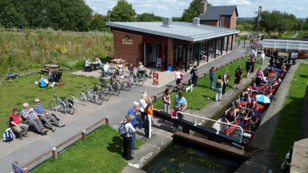
Canoeists in a lock with building and people around

Facts & Stats

2 tunnels

One of the canal’s tunnels, Norwood tunnel, collapsed at the start of the C20th.

65 locks

46 of the 65 locks found on the canal are navigable. 59 are narrow locks and 6 are wide.

12 miles

Since 1989, 12 miles of the Chesterfield Canal have been restored including 37 locks and 11 bridges.

From the River Trent to Chesterfield

The Chesterfield Canal was opened in 1777 and was one of the last of the canals to be designed by James Brindley.  The canal is 46 miles long and runs from the River Trent at West Stockwith in Nottinghamshire, passing through South Yorkshire and on to the centre of Chesterfield in Derbyshire.  The canal was built to link Chesterfield, Worksop and Retford to the River Trent to gain access to more trade. Local Anston Stone was transported along the canal to the river to be used in the construction of the Houses of Parliament.

In the 1800s, the Chesterfield Canal was a huge commercial success due to the transportation of locally mined coal.  However, mining coal caused subsidence in the Norwood Tunnel in 1907, causing the top end of the canal to be cut off.   Subsequently, the main purpose for the Chesterfield end of the canal was to provide water to the iron industry.  Over the other side of the collapsed tunnel, freight haulage via the canal continued between Worksop and West Stockwith until the late 1950s.

 

The restoration of the Chesterfield Canal

In June 2003, the entire canal from the River Trent to the eastern entrance to the collapsed Norwood Tunnel became navigable when the section between Shireoaks and the tunnel was re-opened.  At the western end of the canal the stretch from Chesterfield to Staveley is also completely restored.

Staveley Town Basin opened in 2012.  There are slipways at Tapton Lock in Chesterfield and Staveley Town Basin. There is also a craning pad at the basin.

£50,000 was awarded to Rewatering Renishaw Phase 1a project as part of IWA’s Waterways in Progress Grants in 2019. Chesterfield Canal Trust’s Rewatering Renishaw project seeks to transform and extend the derelict channel into a permanent waterspace. The project is part of Phase 1 of the Chesterfield Canal Trust’s ambition to restore the canal to full navigation by 2027, the 250th anniversary of the canal’s original opening.

The complete Phase 1 works will extend the current limit of navigation from the town of Staveley to the village of Renishaw, and include the construction of three new accommodation bridges, four new bridleway bridges, a lock, a railway overbridge, an aqueduct and approximately 5km of new or restored channel.

This leaves nine miles to be restored. There are detailed plans for the entire stretch, prepared by the Chesterfield Canal Partnership.

Waterway notes

Maximum boat sizes

  • Length: 71′ 4″ (21.75 metres) – Whitsunday Pie Lock, Retford Lock and Thorpe Treble Lock
  • Beam: 6′ 10″ (2.08 metres) – Retford Lock and Stret Lock
  • Height: 7′ 1″ (2.15 metres) – Smiths Flat Deck Bridge
  • Draught: 2′ 6″ (0.76 metres) – Stret Lock

Navigation authority

Useful info

A Sanitary Station key is required to operate locks 41A to 64 (Boundary Lock to Misterton).

A handcuff key is required to operate lock 20 (Top Treble Lock 1).

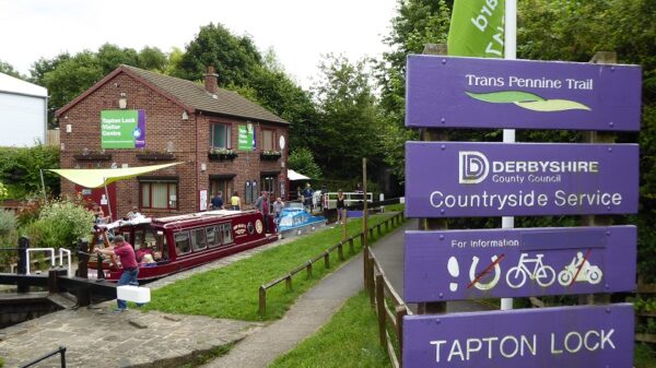
A special key is required for all the locks at the western end which is, available from Tapton Lock Visitor Centre.

Lock 65 (West Stockwith) enters the tidal river Trent

Waterway restoration

Restoring the UK’s blue infrastructure – our inherited network of navigable canals and rivers – is good for people and places.

Waterways affected by HS2

We’re campaigning to protect canals and rivers from the damaging effects of HS2, especially where the tranquillity of the waterways is under threat.

Waterway underfunding

Hundreds of miles of waterways – along with their unique heritage and habitats – are currently starved of funding and rely on constant lobbying by us to safeguard their future.

Waterway underfunding

Hundreds of miles of waterways – along with their unique heritage and habitats – are currently starved of funding and rely on constant lobbying by us to safeguard their future.

Sustainable Boating

We want boating on canals and rivers to be more sustainable and – even though the current overall contribution to UK carbon emissions is very small – we want to help reduce emissions on the waterways.

Waterways Heritage at Risk

Britain’s canals and rivers are a unique, living heritage. But that heritage is at risk – from urban development, lack of protection, loss of skills and knowledge and climate change.

You can help Save Waterways Heritage.

Waterway restoration

Restoring the UK’s blue infrastructure – our inherited network of navigable canals and rivers – is good for people and places.

Local activities