account arrow-down arrow-left arrow-right closecontact-us emailFacebookheart instagramjoin linkedin phonepinterestplaysearch twitteryoutube

Kempston Mill, Great Ouse

Accessible to all craft kept on the connected inland waterways

Silver Propeller Challenge

Location

Bedford

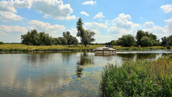
Visit Kempston Mill on the River Great Ouse by boat or canoe.

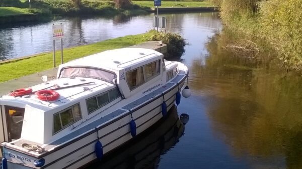
The last stretch needs dredging and deeper draughted boats may not make it to the turning point beside the residential development on the site of the old Mill. This is just upstream of the footbridge and before Kempston Mill Weir. Bedford and Milton Keynes Waterways Trust has a project to improve navigation and provided a new landing stage in 2022. For the purposes of the Silver Propeller Challenge, a photograph showing your boat moored at the new landing stage (see photo below) or as near to there, beyond Bedford, as your vessel’s draught allows, will suffice.  Canoeists and others in small craft should not approach the weir, where there may be dangerous undercurrents.

Complete our challenge by visiting 20 locations from our list, you will receive our exclusive plaque and goody bag.


About the River Great Ouse

The Great Ouse is one of the longest British rivers at 143 miles and the longest of several named Ouse. From Northamptonshire, it flows into The Wash near Kings Lynn. Flowing through the low lying Fenlands the river joined the sea near Wisbech in the Dark Ages, but the course of the river changed several times during floods. The great drainage schemes of the 1600s defined the present course. Always important as a means of moving goods and trade, navigation was extended up to Bedford in 1689 by the construction of pound locks or sluices as they are known locally.

The sole connection to the connected waterways network is via a short tidal passage between Denver Sluice and Salters Lode on the Middle Level. The proposed 16-mile Bedford & Milton Keynes Waterway would link the Great Ouse, near Kempston Mill, to the Grand Union Canal in Milton Keynes.  A partnership led by Bedford & Milton Keynes Waterway Trust  includes the local councils, IWA, Canal & River Trust, Great Ouse Boating Association and the Environment Agency.  The waterway would be the core of a linear water park providing great social, economic and environmental benefits. It would create a new cruising ring and extend the available waterways for southern wide beam boats.

The upper river had been long disused but restoration of navigation to Bedford was finally completed in 1978 through the efforts of the Great Ouse Restoration Society supported by IWA’s Waterway Recovery Group. The reopening celebrations led to the bi-annual Bedford River Festival. The river is managed by the Environment Agency.  The official Head of Navigation on the River Great Ouse is at Kempston Mill, about 3 miles upstream of Bedford Lock.

[Photo, from Bedford & Milton Keynes Waterway Trust, shows narrow boat Grace, the first boat to visit the new landing stage, in September 2022]

Navigation Notes

Location

Postcode: MK42 7FB

What3words /// rejoiced.saucepan.tiredness

Boat Dimensions

The maximum size of boat that can navigate to Bedford:

Length: 26m (85′ 4”)
Beam: 3.15m (10′ 3”)
Height: 2.05m (6’ 9”)

There is a slipway at Priory Marina.

Notes for Boaters

  • Watch out for rowers as you come out of Bedford Town Lock, and head over to the far side (right) heading upstream.
  • Both railway bridges in Bedford have low headroom.
  • Keep to the left of Honey Hill Islands
  • Keep to the right of the next island, just after the concrete landing stage on the left.
  • Shallow draught boats may make it to the formal limit of navigation at Kempston Mill, subject to getting under the very low bridge just before it. Deeper drafted boats may not get far beyond the island before running out of depth, although Bedford & Milton Keynes Waterway Trust have had some dredging carried and hope to get some more done.
  • On the way back watch out for the channel to the right of Honey Hill Islands, which is under pylons – but you can’t see it until you are close (the sign on the island is obscured by vegetation). Beware of a protruding horizontal telegraph pole on the upstream end of the island.
  • Watch out for small craft throughout.
  • Don’t approach the weir at Kempston Mill; there are dangerous undercurrents.

Canoeing, Trip Boats and Boat Hire

Canoeing is encouraged on the River Great Ouse with an Environment Agency licence or British Canoeing membership.

The Bedford & Milton Keynes Waterway Trust Trip Boat John Bunyan offers trips towards Kempston Mill.  The new landing stage was built for use by this trip boat.

Canoe and kayak hire and guided canoe trips are available from Canoe Trails.

Also see…

Bedford Riverside has moorings immediately upstream of the Town Bridge, which gives good access into the town; there is a museum with an array of pubs and eating places.

Challenge Location

Kempston Mill

Location is the limit of navigation at Kempston Mill, or as near there, above Bedford, as deeper draughted boats can reach.


Discover more nearby

Related activities

Waterway underfunding

Hundreds of miles of waterways – along with their unique heritage and habitats – are currently starved of funding and rely on constant lobbying by us to safeguard their future.

Sustainable Boating

We want boating on canals and rivers to be more sustainable and – even though the current overall contribution to UK carbon emissions is very small – we want to help reduce emissions on the waterways.

Waterways Heritage at Risk

Britain’s canals and rivers are a unique, living heritage. But that heritage is at risk – from urban development, lack of protection, loss of skills and knowledge and climate change.

You can help Save Waterways Heritage.

Waterway restoration

Restoring the UK’s blue infrastructure – our inherited network of navigable canals and rivers – is good for people and places.