account arrow-down arrow-left arrow-right closecontact-us emailFacebookheart instagramjoin linkedin phonepinterestplaysearch twitteryoutube

Maud Foster Windmill, Witham Navigable Drains

Accessible to all craft kept on the connected inland waterways

Silver Propeller Challenge

Location

Boston

Visit Maud Foster Windmill in Boston on the Witham Navigable Drains by boat or canoe.

It has been chosen as a Silver Propeller Location due to the small number of visiting boats. A photo of your boat near the windmill or moored at the ‘Packet Boat’ steps will be a good proof of your visit.

To turn around, boats up to 65′ should continue past the Mill, Packet Boat steps and turn around after the main A16 road bridge, where the wall finishes and the grass banks start. Larger boats can turn further down towards the tidal sluices.

Complete our challenge by visiting 20 locations from our list, you will receive our exclusive plaque and goody bag.


About the Witham Navigable Drains

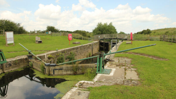
The Witham Navigable Drains are part of a much larger drainage system managed by the Witham Fourth District Internal Drainage Board and the Environment Agency.  Several attempts to drain the fens were made before the current network was constructed in the early nineteenth century.  The use of the drains for navigation was first proposed in 1779 with a lock to connect to the River Witham.  Anton’s Gowt Lock is named after Sir Anthony Thomas, one of the people who helped drain the Witham Fens from 1631 onwards and “gowt” meaning a sluice or outflow; probably originating from ‘go out’.  Some of the drains were adapted for boats and the network originally had five locks.

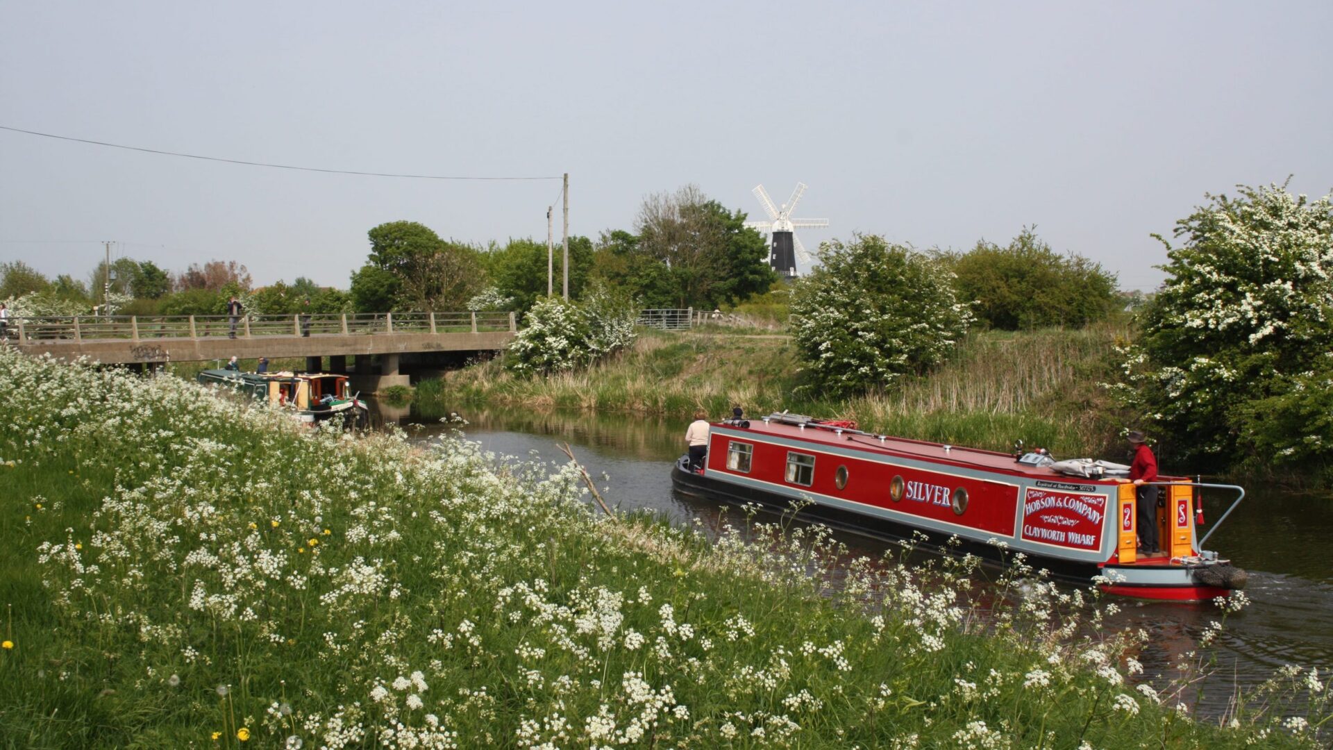
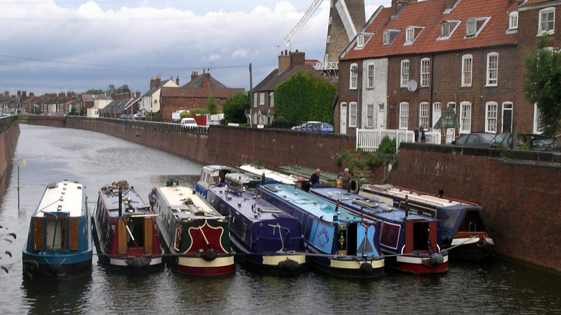
The Maud Foster Drain and Windmill take their name from the land owner whose donation of land in 1564 enabled Boston to be saved from flooding through the digging of a new cut.  The Maud Foster Windmill is a tower mill with five sails.  It is one of the tallest in the UK and was built in 1819 for the brothers Thomas and Isaac Reckitt whose company later became Reckitt & Colman and now Reckitt Benckiser.  The mill succumbed to mechanical problems in 1948, but was repaired by the Reckitt Family Charitable Trusts and again by the present owners.

The Drains are primarily for drainage purposes and water levels are lowered from October to April to provide more capacity for winter rainfall making navigation impossible.  The water level is indicated on a gauge at the tail of Anton’s Gowt Lock.  The most straightforward route to the Maud Foster Windmill is to head east (turn right) from Anton’s Gowt along Frith Bank Drain to the junction at Cowbridge Lock, and then south into Boston along the Maud Foster Drain.

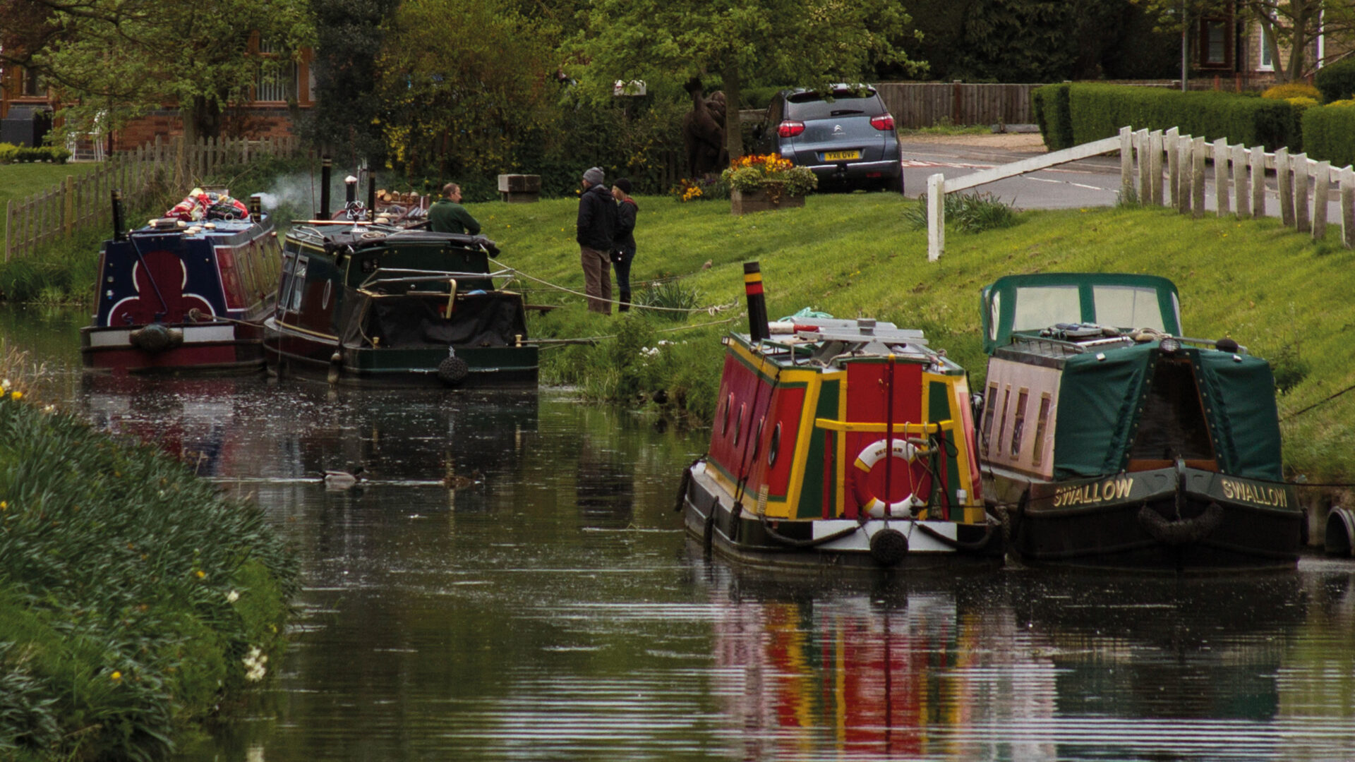
[The photo shows an IWA Lincolnshire gathering of boats in Boston on Maud Foster Drain]

Note for visitors

Location

Postcode: PE21 9EG

What3words /// lend.heap.damage

Boat Dimensions

The maximum boat size that can navigate the Witham Navigable Drains is:

Length – 70′ 0″ (21.34 m) Cowbridge Lock
Beam – 10′ 0″ (3.05 m) Cowbridge Lock
Height – mostly at least 6′ 0″ (1.83 m) at datum water level.
Draught – varies (check gauge).

Cowbridge Lock requires a Canal & River Trust key and will accommodate a 71’ 6” narrow boat with care.

Canoeing, Trip Boats and Hire Boats

Canoes are welcome on the Witham Navigable Drains; licences are not required.

There are no trip boats or hire boats on the Drains.

Also see…

Maud Foster Windmill is open to the public to see the milling taking place.

Boston Stump (St Botolphs Church) is one of the largest parish churches in England, with good views from the tower.  It is 10 mins walk from the windmill.

Challenge Location

Maud Foster Windmill

Boston, Maud Foster Drain.

Discover more nearby

Related activities

Waterway underfunding

Hundreds of miles of waterways – along with their unique heritage and habitats – are currently starved of funding and rely on constant lobbying by us to safeguard their future.

Sustainable Boating

We want boating on canals and rivers to be more sustainable and – even though the current overall contribution to UK carbon emissions is very small – we want to help reduce emissions on the waterways.

Waterways Heritage at Risk

Britain’s canals and rivers are a unique, living heritage. But that heritage is at risk – from urban development, lack of protection, loss of skills and knowledge and climate change.

You can help Save Waterways Heritage.

Waterway restoration

Restoring the UK’s blue infrastructure – our inherited network of navigable canals and rivers – is good for people and places.