The Floating Harbour
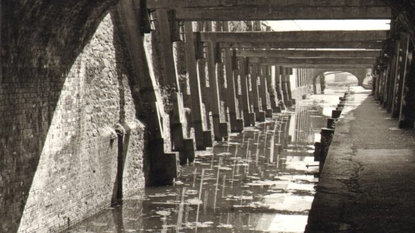
Bristol had long been used as a port and Acts of Parliament were passed in the 18th century to improve the navigation. The Floating Harbour was built in 1810 to allow sea-going ships to load and unload right in the city centre.
Campaign history
Saving Bristol’s Unique ‘Floating’ Harbour
Bristol City Council regularly enthuses about the economic boost the Harbour Festival brings to the city, so it is appropriate to celebrate the 40th anniversary of the first Bristol Water Festival, and reflect on how close Bristol came to losing it’s historic dock. The fact that the floating harbour it is still there is attributable to a band of volunteers from the local branch of the Inland Waterways Association and the Cabot Cruising Club, who in 1971 organised the first Bristol Water Festival to demonstrate the leisure and amenity potential of the harbour.
Chronological sequence
In the 1960’s there was a general move towards larger ships and container traffic, and the Port of Bristol Authority, then owned by the City and County of Bristol, announced it’s intention to close the Bristol docks, encouraging shipping into Avonmouth Docks and using road haulage for transhipment. This was the era when motor transport was seen as the future, also the time of many rail closures. The first ‘alert’ about the harbour’s future occurred in 1969 when it was noticed that the 1967 Development Plan included a road over the harbour at Jacob Wells that would have severed the dock.
Many meetings of interested parties took place in 1969, but the principal objectors were the Inland Waterways Association (South Western Branch), Cabot Cruising Club, Bristol Civic Society, and Clifton and Hotwells Improvement Group. A chance meeting with Fred Blampied meant that the group acquired the services of a local Barrister, Paul Chadd QC to speak for them.
The Council’s plan included ending the Right of Navigation through the harbour requiring an Act of Parliament. The protesting bodies held a public meeting in the Folk House on 3 December 1969 and requested a Town Meeting, such a gathering being required under the Local Government Act before any Parliamentary Bill could be promoted. This meeting took place on 15 December 1969 in the Colston Hall where ratepayers voted by 560 to 164 to reject the Council proposals. However, the Council then decided to carry out a city wide ‘public consultation’ exercise, heavily promoting their own views, and refusing to include any counter arguments by the objectors in the consultation package, although this was at Ratepayers expense. The objectors therefore printed and circulated their own literature, but the result in February 1970 was a narrow victory for the Council from a 13% poll, so the Council embarked on a Parliamentary Bill.
The Council’s own public consultation document displayed the dramatic extent of the project that was to fill in 50% of the floating harbour. The plan shows the Outer Circuit Road sweeping down from Clifton to a huge roundabout near Coronation Road, and on towards Bedminster. Bush’s Warehouse that now houses the Arnolfini was to be demolished along with warehouses to make way for another new road from the bottom of Jacob’s Wells Road across St Augustine’s Reach and past Queen Square, this would have closed off St Augustine’s Reach to water traffic. The Feeder Canal was to be filled in to widen Feeder Road, and the whole area around Hill’s dockyard that now houses the Great Britain and Bristol Marina was also to be filled in, and just a narrow channel left to the Bathhurst Bridge area.
Those opposed fought the proposal right up to the House of Lords, and in early 1970 Paul Chadd QC made the presentation on behalf of the objectors, this resulted in a visit to Bristol by some of their Lordships to view the Bristol harbour. A very active debate occurred in the Upper Chamber on 5 March 1970, but eventually it was decided that a Select Committee should be set up. This was a financial step too far for the objectors, so left the Council with an unopposed run to obtain a Bill, but many useful amendments eventually occurred because of the representations.
To place other events in context, the SS Great Britain returned to Bristol in 1970.
The Inland Waterways Association had been holding campaign rallies round the country since 1950 to save the canal network, but it did not support the local member’s objections. Consequently in late 1970, Fred Blampied, then chairman of the South Western Branch of the Inland Waterways Association, suggested that a local ‘rally of boats’ should be held to demonstrate the leisure and amenity potential of the harbour. This suggestion was supported by Cabot Cruising Club, an organisation more orientated to seagoing craft. In January 1971 the Docks Committee gave approval for the use of the harbour for an event, and also the ground floor of ‘V’ Shed to use as a display area. This shed was originally a bonded sherry warehouse but at that time used as a stolen car pound and also due for demolition as part of the scheme. An organising committee was quickly formed comprising:
- Chairman John Leech Cabot
- Vice Chairman Ron Oakley IWA
- Hon Secretary Helen Lane IWA
- Asst Secretary Julian Moller Cabot
- Publicity Peter Elliott Cabot
- Moorings John Britton Cabot
- Members Fred Blampied IWA
- Bill Elston Cabot
The above were the hard core of people who went on to raise funds to organise the first Bristol Water Festival, and subsequent two years.
The first Bristol Water Festival was held on 25/26 June 1971, and proved an enormous success. So how was this done? It is probably best to say that a ‘Dunkirk spirit’ prevailed in the boating world. About 90 craft attended and were concentrated in St Augustine’s reach to provide for the first time a spectacle of leisure craft to demonstrate the leisure and amenity potential of the harbour. This included 25 small craft that came down from the Midlands waterway system in an escorted convoy from Sharpness to supplement local craft from the Bristol Avon and visitors from South Wales ports. 29 organisations exhibited in ‘V’ shed. There was a formal civic party to open the event, there was a lot of favourable comment in the Press, and a precedent was set for the future.
In August 1971 the Council obtained their Parliamentary Bill to alter the harbour which had become the Bristol Corporation Act 1971, but with significant amendments:
- A continued Right of navigation through the floating harbour to Totterdown Lock ( This still left the Feeder canal at risk of closure)
- No narrowing or division of the Harbour into lagoons ( ie no infilling)
- Minimum headroom 11 feet and minimum depth 6 feet 6 inches
- Right to bring craft up to 70 feet headroom and 12 feet draught into the harbour.
In November 1971 the joint committee decided to hold another BWF in 1972, and by this time the Council had appointed Sir Hugh Casson to advise on development potential for leisure and recreation.
The 1972 Bristol Water Festival on 1/2 July was much bigger event with around 150 vessels attended including 35 in the convoy from Sharpness. The significant difference was the presence of several large vessels:
- HMS Palliser (Type 14 anti-submarine frigate of 310 feet length)
- HMAV Abbeville (Mk 8 tank landing craft complete with DUKW’s)
- TS Royalist (Sea Cadets recently commissioned sailing Brig)
- Training Vessel Margherita (Llandaff College)
Because the Feeder canal was still under threat of closure, an effort was made to improve it’s appearance and present it as a green finger into the city. In March 1973 the IWA local Branch organised a working party over 2 weekends that became known as the Totterdown Basin Improvement Project. Over 1000 manhours were spent landscaping with a bulldozer, clearing rubble, painting the dock furniture, and tree planting.
The 1973 Bristol Water Festival on 23/24June was again a huge success having 170 vessels attending including 30 in the convoy from Sharpness. Again there was the significant presence of several large vessels:
- HMS Hecate (Hecla Class Survey Ship)
- HMS Venturer (Coastal Minesweeper)
- HMXSV Puttenham (RN Auxiliary Service Tender)
- Training Vessel Margherita (Llandaff College)
The Feeder Canal link was still under threat and posed a threat to the possible coast to coast route for the Kennet and Avon Canal that was being restored at the time. A second working party was organised called the Feeder Canal Improvement Scheme to improve the visual amenity, this was held in March 1974 and involved clearance and planting 120 trees between Totterdown Basin to Netham Lock. Yet another working party was organised in August 1974 to complete the planned improvements, but by that time things had changed. The Local Government reorganisation of May 1974 created the new County of Avon, and the amendments to the Bristol Corporation Act 1971 had included a 4 year time limit being imposed to carry out the work, so the Bill lapsed.
The Legacy
By 1974 the case for retaining the dock had been proven, Brunel’s ‘Great Britain’ had returned to Bristol and was being restored in the dock where she was built, the timescale specified in the Act to carry out the work had expired, so it was a case of ‘job done’. Bearing in mind the considerable time, responsibility and workload involved in organising the 3 Festivals, the decision was made by the IWA and CCC volunteers to stand down from organising the event.
From 1974 for the following 4 years the annual event was still organised by volunteers with assistance from the Council, but renamed the Bristol Regatta and Rally of Boats. From 1978 Bristol City Council took over completely, renaming the event the Harbour Regatta. The rest as they say ‘is history’, and the whole of the 1800’s waterway system remains as it was first constructed. The subsequent reopening of the Kennet and Avon Canal means that there is still a boating link from Bristol through to the Thames at Reading. ‘V’ shed that had housed the BWF exhibitions used for several years as the Bristol Exhibition Centre, holding among other events several World Wine Fairs that bought considerable trade to Bristol. For several years there was power boat racing in the harbour untill deemed to dangerous, and The Bush Warehouse now houses the Arnolfini Gallery, venue of the recent debate amongst the ‘party leaders’ before the last election.
It is therefore fair to say that the reason the Bristol dock exists today in it’s present form is nothing to do with political foresight, and everything to do with the efforts of volunteers. But there is a further twist to the tale that is often overlooked.
Hydraulic studies from the 1950’s showed that Bristol, which has the second highest tidal range in the world, was at serious risk of flooding if spring tides coincided with floods down the Avon and Frome. In July 1968 Bristol was badly affected by flooding although the tides were not at their maximum. The floating harbour is, and remains a valuable asset to the city as a flood detention reservoir, a fact known and ignored at the time of politicians were preparing to the 1971 Bill.
Acknowledgements
Written by Alan Aldous using records from Fred Blampied, and an article by Peter Cotton.
10 June 2011
Postscript
At the official opening of the event in July 2011, Bristol City Council presented Fred with a unique piece of ‘Bristol Blue’ glass in the shape of a sailing craft engraved:
“Presented to Fred Blampied on the 40th Anniversary of the Bristol Harbour Festival – Bristol thanks you”.
In June 2012 Fred was awarded the MBE for ‘Services to Inland Waterways’.


