account arrow-down arrow-left arrow-right closecontact-us emailFacebookheart instagramjoin linkedin phonepinterestplaysearch twitteryoutube

Chelmer & Blackwater Navigation

The Chelmer & Blackwater Navigation connects Chelmsford with the tidal estuary of the River Blackwater at Heybridge Basin.

Things to do nearby

Springfield Basin, Chelmer & Blackwater Navigation
Automatic Weir, River Chelmer
narrowboat cruising the navigation

Facts & Stats

13.8 miles

or 22.1 km.  The length of the Chelmer & Blackwater Navigation that is navigable.

13 locks

2005

The year Essex Waterways Ltd took over the management of the waterway

Why Heybridge and not Maldon?

The Chelmer & Blackwater Navigation runs through a largely unspoilt part of rural Essex with a footpath along its full length.  The waterway passes highlights such as the lock at Paper Mill and All Saints Church in Ulting, joining the sea at Heybridge.

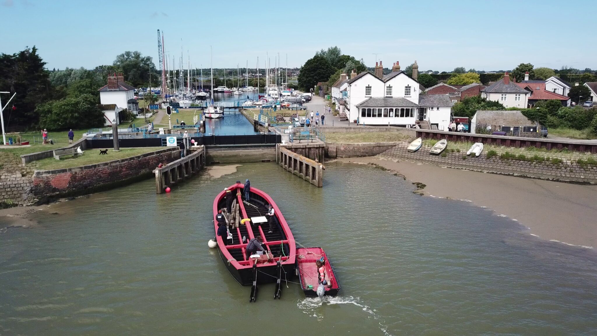
Heybridge, rather than the sea port of Maldon, is the point where the waterway enters the sea as local landowners and other port interests objected to the construction of the Navigation.  They feared it would bring a loss of trade so the community around Heybridge Basin grew following the waterway construction work in the 1790s.  Previously the area had been entirely rural farmland.

Heybridge developed enormously after the opening of the navigation especially with William Bentall’s iron works beside the navigation in about 1811, where iron ore, coal and timber could be easily imported. The business prospered and Heybridge grew from 368 people in 1801 to 1177 in 1841. By 1900 the works covered 13.25 acres. At the beginning of the straight cut beyond Wave Bridge is Bentall’s warehouse, built in 1863 and now a scheduled industrial monument.

The basin could accommodate ships of 300 tons which once brought coal from Newcastle and timber from Scandinavia.

Cricket Bat Willows

Most of the willow trees along the Chelmer & Blackwater Navigation are of a specialist variety of ‘cricket bat willows’ and have been grown as a commercial crop along the banks of the Navigation dating back to the early years of the last century. Trees are planted and felled along the Navigation each year, with trees being felled once they have reached about 20 years or more. Felled trees are always replaced with further plantings, with the whole process in accordance with regulations laid down by the Forestry Commission and in line with the Navigation’s status as a conservation area.

The growing cycle – planting, harvesting, etc – of the cricket bat willows adds to the waterway’s character.  There are trees of all ages in the cycle of planting and harvesting along the Navigation – taking out a few trees and planting new ones each year maintains the variety of habitat along the waterway.  These habitats could otherwise be lost if all the trees were left to reach a uniform maturity together.

All the income from the proceeds of the sale of willows is reinvested in future planting and upkeep of the Navigation, and keeping all areas open to the public to visit.


The role of John Rennie

The navigation is a very broad one and the pound locks (of which there are 11 and one sea lock) measure on average 68 x 17 feet taking vessels measuring 60 feet long, 16 feet of beam and only a two foot draught, making the Chelmer and Blackwater the shallowest navigation in the country.

The bridges and locks were designed by John Rennie, and except for Chapman’s Bridge, Heybridge, they are all constructed of red bricks which were made from brickearth excavated at Hoe Mill and Sawpit Field, Boreham.

The Inland Waterways Association’s subsidiary company Essex Waterways Ltd took over the management of the Chelmer & Blackwater Navigation on 14th November 2005.

Waterway notes

Maximum boat sizes

  • Length: 57′ (17.40 metres)
  • Width: 15′ (4.62 metres)
  • Height: 6′ 3″ (1.9 metres) – Paper Mill road bridge
  • Draught: 2′ 6″ (0.62 metres) – statutory minimum, though much of the waterway is deeper

The Sea Lock at Heybridge Basin can accommodate boats up to 170′ (52.5 metres) x 26′ (8.2 metres) with use of the caisson gate, which extends the size of the lock (93.5′ – 28.5 metres without the caisson gate).  The depth over the upper gates cill is around 15′ (4.5 metres), but silting on the approach (‘the gut’) in the Blackwater Estuary is likely to prevent any vessel with a draught of greater than three metres reaching the lock, and then only on a rising Spring Tide.  Boats up to two metres draught should not experience difficulty on any high tide.

Navigation authority

Essex Waterways

Freehold ownership of the Navigation remains with the original Company of Proprietors of the Chelmer & Blackwater Navigation, but management was taken over by Essex Waterways Ltd in 2005 when the Company of Proprietors went into Administration. Essex Waterways Ltd is a subsidiary company of The Inland Waterways Association.

Waterway underfunding

Hundreds of miles of waterways – along with their unique heritage and habitats – are currently starved of funding and rely on constant lobbying by us to safeguard their future.

Sustainable Boating

We want boating on canals and rivers to be more sustainable and – even though the current overall contribution to UK carbon emissions is very small – we want to help reduce emissions on the waterways.

Waterways Heritage at Risk

Britain’s canals and rivers are a unique, living heritage. But that heritage is at risk – from urban development, lack of protection, loss of skills and knowledge and climate change.

You can help Save Waterways Heritage.

Waterway restoration

Restoring the UK’s blue infrastructure – our inherited network of navigable canals and rivers – is good for people and places.

Local activities