account arrow-down arrow-left arrow-right closecontact-us emailFacebookheart instagramjoin linkedin phonepinterestplaysearch twitteryoutube

Peak Forest Canal

The Peak Forest Canal runs from Dukinfield Junction on the Ashton Canal to the canal’s terminus at Bugsworth Basin.

Map showing the Peak Forest Canal and surrounding waterways

Facts & Stats

14.75 miles

(23.74km)

The length of the Peak Forest Canal.

16 locks

(all in one flight at Marple)

Dunkinfield Junction to Bugsworth Basin

The Peak Forest Canal was built to ship Derbyshire limestone to Manchester.  It reopened in 1974 following restoration led by the Peak Forest Canal Society.

There is one branch, the Whaley Bridge Branch, which is 0.5 miles (0.8Km) long with no locks, and which joins the main line at Bridge 37, just north of Whaley Bridge.  The Macclesfield Canal joins the Peak Forest Canal at Marple Junction.

Bugsworth Basin was fully reopened at Easter 2005 following more than thirty years of work by The Inland Waterways Protection Society Ltd (which latterly changed its name to Bugsworth Basin Heritage Trust), who adopted the unique canal and tramway interchange complex at Bugsworth Basin as its major project.  

The more important and larger of two southern terminals of the Peak Forest Canal, Bugsworth Basin had initially re-opened amid much celebration six years earlier. Unfortunately, the Society and British Waterways had no option but to close the Basin again the following autumn due to excessive leakage and unacceptable water loss to the adjoining river Blackbrook. Substantial works to provide a long-term solution to leakage problem were undertaken in 2004. The Trust’s volunteers continued to maintain the non-water areas for the benefit of all visitors and local residents, with the co-operation with English Heritage, for many years.

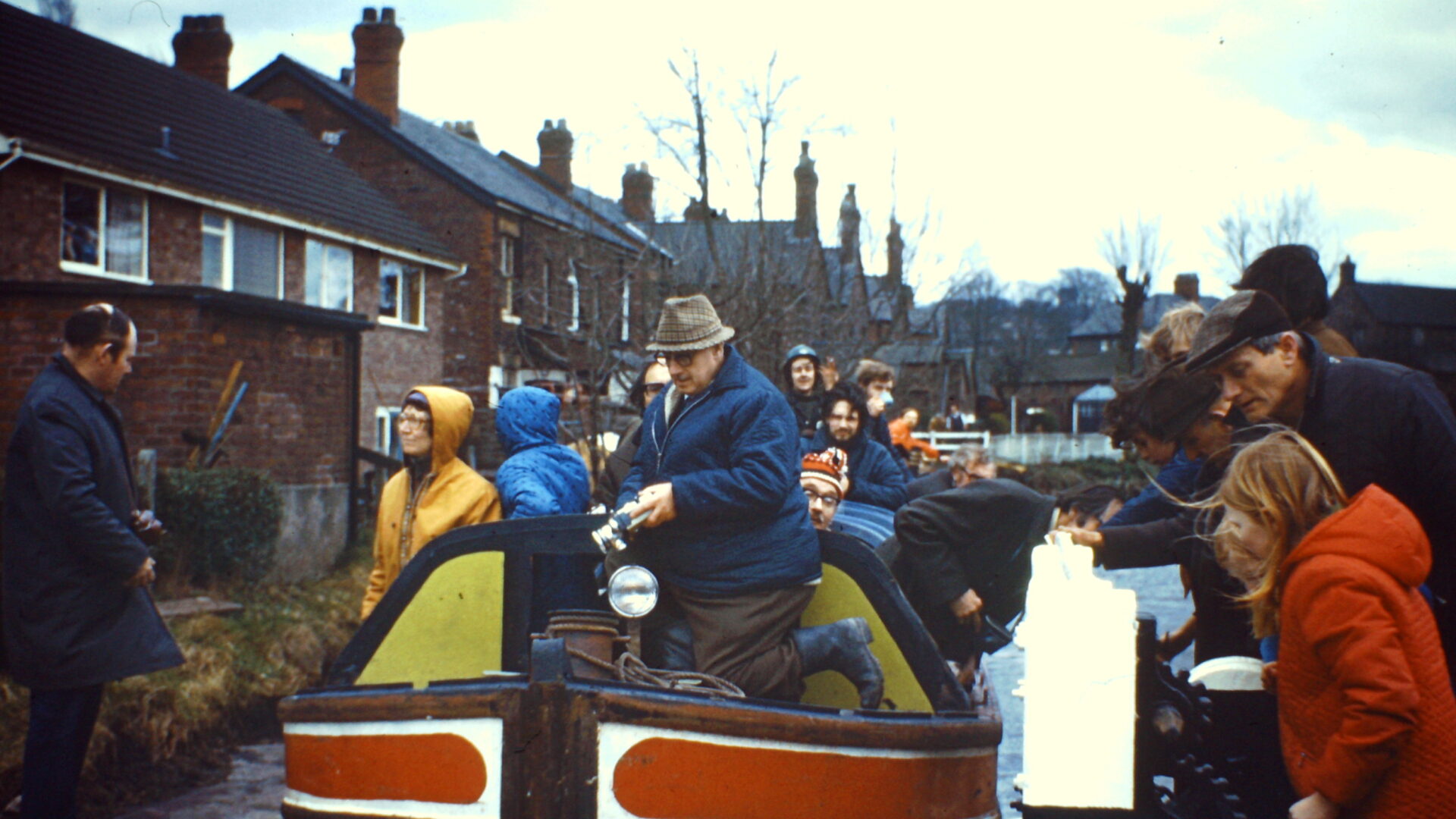
[The photo shows Carr Swing Bridge, Furness Vale  –  by Victor Gibbons]

Waterway notes

Maximum boat sizes

  • Length: 72′ 8″ (22.15 metres) – Lock 11
  • Beam: 7′ 3″ (2.2 metres) – Lock 11
  • Height: 6′ 5″ (1.95 metres) – Bridge 1b (near Dukinfield)
  • Draught: 4′ 5″ (1.35 metres) – cill of Lock 11

Navigation authority

Useful Info

  • A handcuff key is required for Bridge 1 (Stanley Lift Bridge)
  • A handcuff key and a windlass are required for Bridges 22 (Turflea Lift Bridge) and 24 (Wood End Lift Bridge).
  • A Sanitary Station key is required for Bridge 25 (Higgins Clough Swing Bridge) and Bridge 30 (Carr Swing Bridge)
  • Mooring is not permitted overnight in the Marple Flight, as water levels can fluctuate considerably when the locks are in use.
  • Despite initial appearances, there is insufficient room through Hyde Bank Tunnel for two boats to pass. It is essential to check the tunnel is clear before entering.

Waterway underfunding

Hundreds of miles of waterways – along with their unique heritage and habitats – are currently starved of funding and rely on constant lobbying by us to safeguard their future.

Sustainable Boating

We want boating on canals and rivers to be more sustainable and – even though the current overall contribution to UK carbon emissions is very small – we want to help reduce emissions on the waterways.

Waterways Heritage at Risk

Britain’s canals and rivers are a unique, living heritage. But that heritage is at risk – from urban development, lack of protection, loss of skills and knowledge and climate change.

You can help Save Waterways Heritage.

Waterway restoration

Restoring the UK’s blue infrastructure – our inherited network of navigable canals and rivers – is good for people and places.