account arrow-down arrow-left arrow-right closecontact-us emailFacebookheart instagramjoin linkedin phonepinterestplaysearch twitteryoutube

Birmingham Canal New Main Line

The Birmingham Canal New Main Line runs for 15 miles from the centre of Birmingham to Tipton.

Birmingham Canal New Main Line Map

Facts & Stats

15.4 miles

(24.8 km)

The length of the Birmingham Canal New Main Line which is navigable.

24 locks

1838

Improvements to the main line were completed, shortening the through route between Birmingham and Wolverhampton by 7 miles.

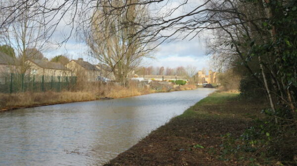
From Birmingham to Wolverhampton

Today the Birmingham Canal Main Line cuts a pretty much straight line from Gas Street Basin in the centre of Birmingham to Tipton.

The Birmingham Canal, from Birmingham to Wolverhampton, was completed in 1772 and today forms the ‘Main Line’ of the Birmingham Canal Navigations (BCN), a complex network of waterways at the centre of the English canal system.  The canal was built to bring coal supplies into Birmingham and to connect the many growing manufacturers in what became known as the ‘Black Country’ with supplies of raw materials and markets.  As the industrial revolution prospered and canal traffic grew, numerous branches, basins and connecting waterways were built, and major improvements to the Birmingham Canal were made by Smeaton in 1790.

Traffic continued to increase and the locks at Smethwick were agreed to be a bottleneck.  In 1824 engineer Thomas Telford was consulted and recommended extensive improvements to the canal main line.  Starting from Birmingham, by 1827 a new wider and deeper channel with twin towpaths was cut straight across the original winding route, leaving the Ouzells Street Loop, Icknield Port Loop and Soho Loop to serve the extensive works that lined their banks.  These still survive, although the following Cape Loop is largely closed and the Soho Foundry loop has all disappeared.

From Smethwick Junction an impressive cutting was excavated up to 70 feet deep to continue the new canal at the Birmingham level through to Bromford Junction at the foot of the Spon Lane locks.   By Smethwick Top Lock, Telford built an attractive single-span cast iron aqueduct to carry the Engine Arm canal, and several road bridges which cross the Galton Valley cutting, including the magnificent cast iron Galton Bridge.  Near Spon Lane Junction this ‘New Main Line’ canal passes under the more conventional two-arched brick-faced Steward Aqueduct.  This aqueduct carries the original route of the canal which became known as the ‘Birmingham Canal Old Main Line’

Many of the distinctive Horseley Iron Works bridges carrying the towpaths over new junctions were also erected at this time, with some later additions made at the Toll End Works.

Toll Islands in the new Main Line

A unique feature of the New Main Line is the toll islands built midstream at various key points.  These originally carried a small brick tollhouse and many have central lay-by channels for gauging boats.  None of the original tollhouses survive but a replica has been built at Smethwick Top Lock.  As part of his improvements, Telford also built the Rotten Park or Edgbaston reservoir in 1826 which fed both into the Soho Loop and by a long feeder into the end of the Engine Arm.  This superseded the original Smethwick Great Reservoir which has since been built over.

The Galton Valley section was opened by 1829 and the huge amount of material excavated was already being used to build the extensive embankments of the ‘Island Line’ which continues the New Main Line from the Wednesbury Old Canal at Pudding Green Junction in a dead straight line for over 2 miles to Tipton.  Here the 3 Factory Locks raise it to join the Old Main Line again at Tipton Factory Junction.  From Tipton a new canal through Coseley Tunnel was built, again with twin towpaths, cutting out the long and circuitous Wednesbury Oak Loop, part of which remains open today as the Bradley Arm.  All these improvements were completed by 1838 and shortened the through route by no less than 7 miles, from 22½ miles to 15½ miles.

Waterway notes

Maximum boat sizes

  • Length: 70′ 11″ (21.62 metres)
  • Beam: 7′ 4″ (2.24 metres)
  • Height: 7′ 5″ (2.26 metres)
  • Draught: 4′ 4″ (1.32 metres)

Navigation authority

Waterway underfunding

Hundreds of miles of waterways – along with their unique heritage and habitats – are currently starved of funding and rely on constant lobbying by us to safeguard their future.

Sustainable Boating

We want boating on canals and rivers to be more sustainable and – even though the current overall contribution to UK carbon emissions is very small – we want to help reduce emissions on the waterways.

Waterways Heritage at Risk

Britain’s canals and rivers are a unique, living heritage. But that heritage is at risk – from urban development, lack of protection, loss of skills and knowledge and climate change.

You can help Save Waterways Heritage.

Waterway restoration

Restoring the UK’s blue infrastructure – our inherited network of navigable canals and rivers – is good for people and places.

Local activities